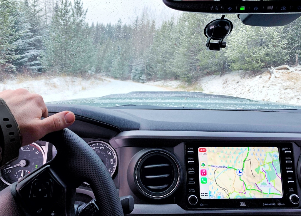
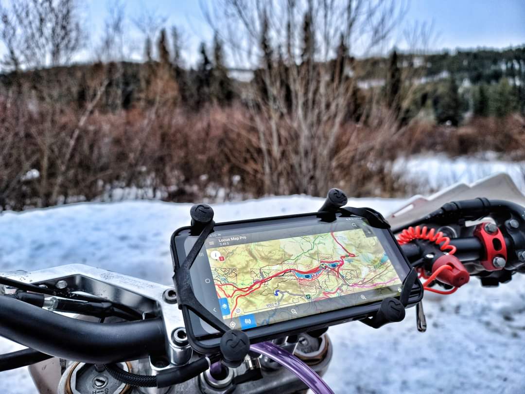
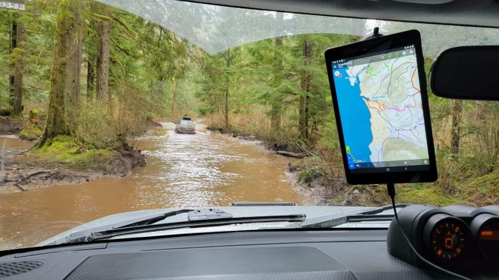
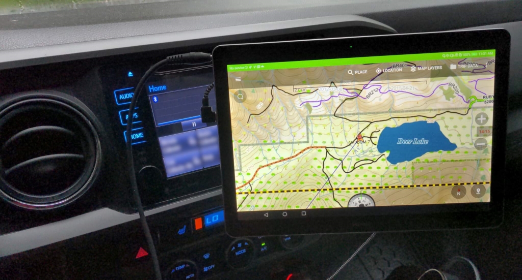
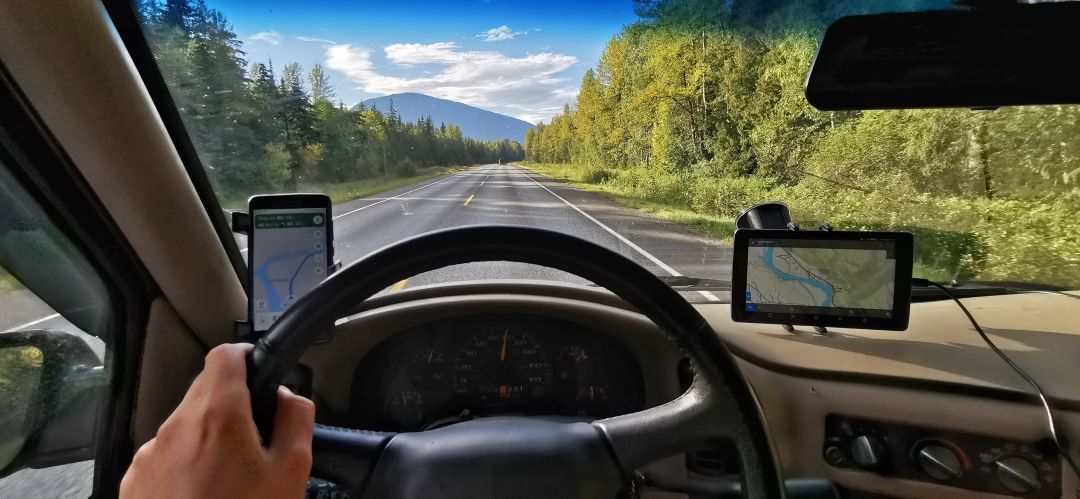
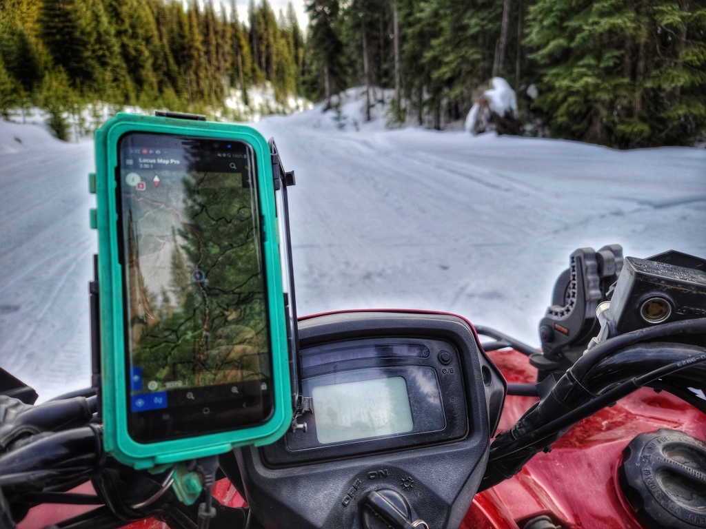
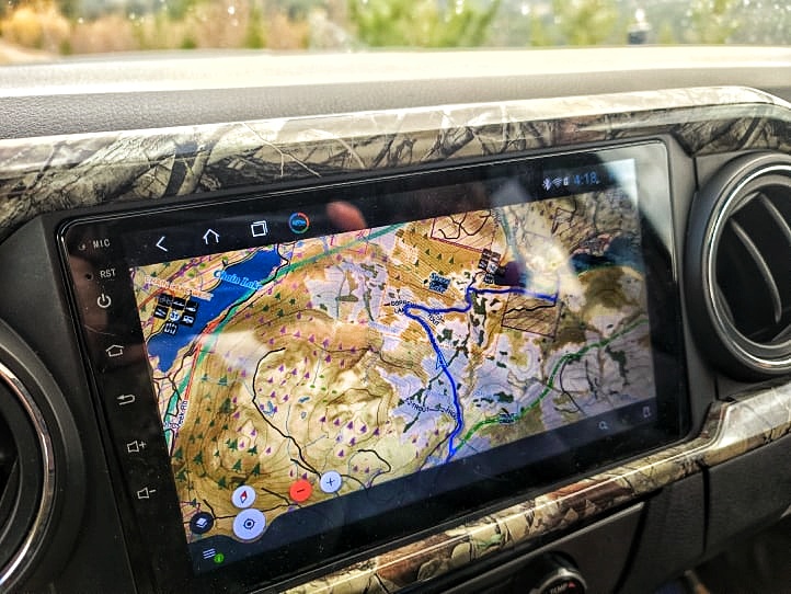
The ultimate tool for any BC outdoor enthusiast. Top Notch Navigator is a series of offline map files you can use to replace the default content in other popular navigation apps. These fully custom topographic maps include a stack of layers chosen to enhance your offline navigation experience. Turnkey offline ready files that use GPS tracking on your phone or tablet via the popular apps Gaia GPS, Locus Maps, Canada Topo Maps, OsmAnd, and many others. No cell service? No data? No problem.
Top Notch Navigator maps are a one time purchase, no subscription. Existing users that buy the full province receive discounts for $15 updates to future versions of the maps, which occur every spring.
Perfect for Off-roaders & Wilderness Pros
Top Notch Navigator is perfect for camping, exploring, and of course off roading. If you want to take it a step further; our Wilderness Layers are geared towards hunters, foragers, nature photographers, and field naturalists. This package is unmatched with additional wildlife, forestry, and ecology layers you won't find in other sources. If you are looking to do extra analysis or e-scouting, Top Notch Navigator stands alone.
Wilderness Pro goes above and beyond the average recreation maps. This package has all the same features as the Offroading maps, but with additional wildlife, forestry, and ecology layers. Top Notch Navigator maps are a one time purchase, no subscription. Users that buy the full province receive discounts for $15 updates to future versions of the maps, which occur every spring.Click here to check out the demo video!This package is made for hunters, foragers, nature photographers, and field naturalists. If you are looking to do extra analysis or e-scouting, Wilderness Pro stands alone. Here is a summary of the additional layers included:WMU - Wildlife Management Units
Used to set regulations for hunting and fishing, as well as provide information to support land & resource management decisions.
Legal Boundaries
• Crown land, private land, crown leases
• First nation boundaries
• Municipal Limits
• National/provincial parks, ecological reserves, conservancies, & protected areasNo Shooting ZonesNo Shooting Zones from the BC Hunting Synopsis as well as the No Shooting Areas of the Fraser Valley Regional DistrictForestry Activity
Recent Cutblocks: Recent cutblocks are highlighted when they are 5 years old or more recent to indicate likely height of sapling regeneration to improve line of sight. This is also a good indicator of road maintenance activity.
Retention Areas & Internal Patches: Areas that fall within cutblock boundaries that have been left for retention purposes. These indicate areas preserved for wildlife, riparian/water features, and overall retention of the local forest stand.
Mature Forest Cover
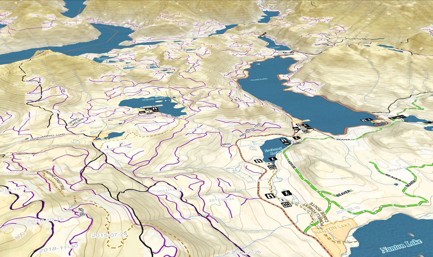
Wilderness Pro is the only BC wide map provider that includes forest cover. The forest cover layers display the leading/dominant species and their age groupings. Maturity, of course, varies between species however these age ranges will be visibly distinguishable in the field. Immature forest stands, are not displayed.Local forest cover can indicate the micro climate of a particular stand and has an effect on the vegetation that will be present on the ground. Understanding of the environment preferred by each species can give insight into the ecology of a specific area.
Big Treed Old GrowthBig-treed old growth is naturally rare. And, since it has been heavily targeted by harvesting, big-treed old growth is now very rare compared to its historic distribution. Ancient Old GrowthThis category includes forests that have developed without a stand-replacing disturbance for many centuries or millennia. These are identified as over 400 years old in ecosystems with rare stand-replacing disturbance and over 250 years with more frequent disturbance (ie. fires). Historical Forest FiresWildfire perimeters for fire seasons from the past 10 years. Recent wildfires are well known
hotspots for morel mushrooms, and have a significant impact on wildlife behavior.
Ungulate Winter Range & Migration Corridors
An Ungulate Winter Range (UWR) is defined as an area that contains habitat that is necessary to meet the winter habitat requirements of an ungulate species, for foraging as well as thermal cover from the forest canopy and shelter from snowfall. Some ungulates migrate seasonally to take advantage of new habitats, new food sources, water availability, protection for calving, and other reasons.
Grizzly Bear Habitat/Range
Grizzly habitat and range is included from multiple sources to reflect the known coastal habitats and interior ranges.
Alpine DesignationOccurs at high elevations and has the harshest climate in the province. Generally considered to be treeless.Beetle Infestation
Douglas-Fir Beetle
Western Balsam Bark Beetle
Lodgepole/Mountain/Western Pine Beetle
Spruce Beetle
Tidal Fishing Management AreasThe British Columbia coast is divided into DFO Pacific Fisheries Management Areas (PFMAs). Each PFMA is then divided into a number of subareas, delineations originally designed for salmon fishery management. These DFO management areas and subareas are now used to record catch and effort information for numerous fisheries, including shellfish.Rockfish Conservation AreasFisheries & Oceans Canada have implemented 164 Rockfish Conservation Areas coast-wide. Any fishing activities that impact rockfish, lingcod, or their habitat are prohibited.Kelp ForestsKelp forests provide important three-dimensional, underwater habitat that is home to hundreds or thousands of species of invertebrates, fishes and other algae.Eelgrass BedsEelgrass beds are a habitat for many different plants and animals, including small invertebrates, fish and birds. It typically grows in finer sediment and is ideal for harvesting dungeness crab.
Wilderness Pro goes above and beyond the average recreation maps. This package has all the same features as the Offroading maps, but with additional wildlife, forestry, and ecology layers. Top Notch Navigator maps are a one time purchase, no subscription. Users that buy the full province receive discount codes for $10 updates to future versions of the maps, which occur every spring and fall. Click here to check out the demo video!This package is made for hunters, foragers, nature photographers, and field naturalists. If you are looking to do extra analysis or e-scouting, Wilderness Pro stands alone. Here is a summary of the additional layers included:WMU - Wildlife Management Units
Used to set regulations for hunting and fishing, as well as provide information to support land & resource management decisions.
Legal Boundaries
• Crown land, private land, crown leases
• First nation boundaries
• Municipal Limits
• National/provincial parks, ecological reserves, conservancies, & protected areasNo Shooting ZonesFraser Valley Regional District No Shooting Areas. Fall 2022 will include No Shooting Areas from other districts.Forestry Activity
Recent Cutblocks: Recent cutblocks are highlighted when they are 5 years old or more recent to indicate likely height of sapling regeneration to improve line of sight. This is also a good indicator of road maintenance activity.
Retention Areas & Internal Patches: Areas that fall within cutblock boundaries that have been left for retention purposes. These indicate areas preserved for wildlife, riparian/water features, and overall retention of the local forest stand.
Mature Forest Cover
Wilderness Pro is the only BC wide map provider that includes forest cover. The forest cover layers display the leading/dominant species and their age groupings. Maturity, of course, varies between species however these age ranges will be visibly distinguishable in the field. Immature forest stands, are not displayed.Local forest cover can indicate the micro climate of a particular stand and has an effect on the vegetation that will be present on the ground. Understanding of the environment preferred by each species can give insight into the ecology of a specific area.
Big Treed Old GrowthBig-treed old growth is naturally rare. And, since it has been heavily targeted by harvesting, big-treed old growth is now very rare compared to its historic distribution. Ancient Old GrowthThis category includes forests that have developed without a stand-replacing disturbance for many centuries or millennia. These are identified as over 400 years old in ecosystems with rare stand-replacing disturbance and over 250 years with more frequent disturbance (ie. fires). Historical Forest FiresWildfire perimeters for fire seasons from the past 10 years. Recent wildfires are well known
hotspots for morel mushrooms, and have a significant impact on wildlife behavior.
Ungulate Winter Range & Migration Corridors
An Ungulate Winter Range (UWR) is defined as an area that contains habitat that is necessary to meet the winter habitat requirements of an ungulate species, for foraging as well as thermal cover from the forest canopy and shelter from snowfall. Some ungulates migrate seasonally to take advantage of new habitats, new food sources, water availability, protection for calving, and other reasons.
Grizzly Bear Habitat/Range
Grizzly habitat and range is included from multiple sources to reflect the known coastal habitats and interior ranges.
Alpine DesignationOccurs at high elevations and has the harshest climate in the province. Generally considered to be treeless.Beetle Infestation
Douglas-Fir Beetle
Western Balsam Bark Beetle
Lodgepole/Mountain/Western Pine Beetle
Spruce Beetle
Tidal Fishing Management AreasThe British Columbia coast is divided into DFO Pacific Fisheries Management Areas (PFMAs). Each PFMA is then divided into a number of subareas, delineations originally designed for salmon fishery management. These DFO management areas and subareas are now used to record catch and effort information for numerous fisheries, including shellfish.Rockfish Conservation AreasFisheries & Oceans Canada have implemented 164 Rockfish Conservation Areas coast-wide. Any fishing activities that impact rockfish, lingcod, or their habitat are prohibited.Kelp ForestsKelp forests provide important three-dimensional, underwater habitat that is home to hundreds or thousands of species of invertebrates, fishes and other algae.Eelgrass BedsEelgrass beds are a habitat for many different plants and animals, including small invertebrates, fish and birds. It typically grows in finer sediment and is ideal for harvesting dungeness crab.
CA$149.99*
Where the Real World and the Digital World Collide
For a level of detail designed for boots on the ground, accept no substitute.
Keeping You on the Map.
Other map services require you to cache your data prior to losing your data signal. Top Notch Navigator isn't a web based platform so you're always covered when you are offline, an essential for backcountry navigation.
No more guessing.
Top Notch Navigator combines all its data from various federal, provincial, and local government databases. All of which are updated regularly and applied with each map revision, giving you the tools you need for navigating the backcountry.
If you have a favorite, why change it?
Everybody has a preference, and each app has it's own strengths and weaknesses. TNN maps are compatible with many popular navigation apps, so you can keep exploring your way.
This website uses cookies to ensure the best experience possible. More information...